Wondering if anyone has any recommendations for Apps for walking routes. I'm late 50s and retired about 6 weeks ago, bit earlier than planned but kind of dictated by circumstance. Used to get enough exercise with work but like many others lockdown rather diminished that. Anyway now I've time on my hands I want to get out and about more and generally get a bit fitter and healthier. Currently wandering around Marton, headphones in listening to my tunes and am more than happy but suspect will need to broaden my horizons to keep it up. Not brilliantly fit but can do an hour ok, few joint issues but wanting to push on. Basically after something showing the paths and cuts in town but also out and about in the fields and countryside. GPS and route tracking would be good, bound to get lost sometime. Any advice appreciated.
You are using an out of date browser. It may not display this or other websites correctly.
You should upgrade or use an alternative browser.
You should upgrade or use an alternative browser.
Walking App Recommendations
- Thread starter Snowbald
- Start date
Zoophonic
Well-known member
i use this app which is fantastic for walks, shows your position on the ordnance survey map by gps and you can map directions too.

OutDoors GPS – Offline OS Maps
EXPLORE the OUTDOORS this SUMMER with the #1 Outdoors Navigation App for iOS ** OutDoors GPS - Your handheld companion to the Outdoors ** OutDoors GPS makes it easy to enjoy the great British countryside with confidence. • At a fraction of the cost of a dedicated GPS device, spend less time...
apps.apple.com
dan_ashcroft
Well-known member
Hi, I've found a couple of threads which may have some info:

 fmttmboro.com

 fmttmboro.com

Hill walking apps
Are there any good free apps that help you plan routes, check where you are etc. I’ve heard about Viewranger and Gridpoint GB are they any good, free or yearly fee?

Tracking app recommendations
Morning all 3 wks furlough starts today and I cant sit on my árse watching daytime tv so I'm going to get my hour exercise in and would like to track routes, distance, steps, etc Any recommendations? Cheers
BobUpnDown
Well-known member
I use OS Maps, other OS users can save their routes which you can then use.. you can save & create your own. £27 a year I think it is
Also Google Street view with satellite overlay.. you can plan your routes very well using both together.
Walking app itself I'm on Huawei Health.. it's ok though sure other apps can be better
Also Google Street view with satellite overlay.. you can plan your routes very well using both together.
Walking app itself I'm on Huawei Health.. it's ok though sure other apps can be better
Ingleby_Flash
Well-known member
Exactly this, I use OS maps virtually every day, so get my moneys worth. I set myself a target of a minimum of 160km (100 miles) every 30 days and log all of my walks. One of the great things about the app is you can have it on multiple devices with the one log in, so you can plan routes on the pc or ipad then follow then on your phone, or just log them on your phone and then re-trace them another time.Hi Snowbald, the Ordnance Survey have made available their entire catalogue on a mobile app. It shows you all footpaths plus your location in 1:25k resolution. Stunning.
ThatFragranceGuy
Well-known member
Doesn't have the best interface but we used viewranger to track down some walks in places we were going to, it uses OS maps as well as other options and users can create walks in it or you can use ones others have already made
London_Boro
Well-known member
Some good tips above. I'm also looking for a good one that has off road Mountain Bike trails mapped out. Any ideas?
afcb_acklam
Well-known member
I use a free app called Komoot, which is great for both planning, navigating & recording walks & I think bike rides (which I don't do)
or on a computer https://www.komoot.com/discover
or on a computer https://www.komoot.com/discover
Last edited:
Norman_Conquest
Well-known member
If you buy an OS paper map, it gives you a code for a free download for that map andc as mentioned above, you can now get all their maps on the OS App.Hi Snowbald, the Ordnance Survey have made available their entire catalogue on a mobile app. It shows you all footpaths plus your location in 1:25k resolution. Stunning.
I love using a paper map and tend to use a 1:25, this gives you more detail than the 1:50 shown above.
Centralscrutinizer
Well-known member
I use a Garmin with Open Maps to follow downloaded routes on my MTB. Can download GPX files of routes from multiple web sites and also from Strava.Some good tips above. I'm also looking for a good one that has off road Mountain Bike trails mapped out. Any ideas?
Emmersons_BrazillianDong
Well-known member
I just purchased OS maps and there's an offer on for the next couple of days to get the first year for, £13. Not used it yet but as above it comes highly recommended

 www.hotukdeals.com
Ordnance Survey Discount Code ➡️ Get 10% Off + Deals, February 2023 | hotukdeals
Ordnance Survey discount codes & deals for February 2023 ▶️ Verified and tested UK voucher codes ☑️ Get the best price and save money - hotukdeals.
chickenrunner
Well-known member
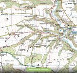
The red line in diamonds is the Cleveland WayJust to show you an example here is the walking route used by Rev Cole’s on Winter Walks on BBC 4 last night. The red line with diamonds.
View attachment 30961
RedAsABeetroot
Well-known member
I used to use Viewranger with an OS map subscription but it is no longer supported by OS so I switched to their own OS maps app. I found both apps very good to use and you can search for routes from specific areas with filters such as activity type, mileage, etc.
The OS map subscription is about £25 and is good value in my opinion.
With both apps I'd download the route and map for offline use before you leave home if you're going to be somewhere where signal may be patchy. A paper map and compass might be a useful backup too.
Both apps will record your route but I prefer to use Strava for that.
Norman_Conquest
Well-known member
I totally agree with the paper map and compass and wouldn't go walking without them.I used to use Viewranger with an OS map subscription but it is no longer supported by OS so I switched to their own OS maps app. I found both apps very good to use and you can search for routes from specific areas with filters such as activity type, mileage, etc.
The OS map subscription is about £25 and is good value in my opinion.
With both apps I'd download the route and map for offline use before you leave home if you're going to be somewhere where signal may be patchy. A paper map and compass might be a useful backup too.
Both apps will record your route but I prefer to use Strava for that.
Can I also suggest you download 'What3Words,' this App will help if you are ever in trouble.
Nobby_Barnes
Well-known member
I'm always in trouble, especially on hereI totally agree with the paper map and compass and wouldn't go walking without them.
Can I also suggest you download 'What3Words,' this App will help if you are ever in trouble.
Norman_Conquest
Well-known member
That is usually because you've used more than three words.I'm always in trouble, especially on here
RedAsABeetroot
Well-known member
Or OS Locate.Can I also suggest you download 'What3Words,' this App will help if you are ever in trouble.
chickenrunner
Well-known member
You've only said that because you know I'm lurking and about to break into a massive rant as to why W3W is an absolute pile of poo.Or OS Locate.
